An Ultimate ‘States in Mexico’ Guide – Stats, Maps, & Info
Table of Contents
Mexico is a wonderful country to visit and live in. We’ve been traveling as tourists to Mexico for the past 10 years and have been living here full-time for the past three. While we haven’t visited all of the states in Mexico yet, we have researched them extensively.
How Many States in Mexico?
This can get a little confusing.
The answer you’ll hear most is that there are 32 states in Mexico. The correct answer is there are 31 states in Mexico, plus the capital of Mexico; Mexico City (CDMX).
All 31 states in Mexico are considered “federal entities”. Mexico City (CDMX) is also considered a “federal entity”, which is what causes all the confusion.
So, if you’re asked, “how many states in Mexico are there”, either one of the following answers is correct:
- There are 32 federal entities in Mexico, 31 of which are states.
- There are 31 states in Mexico plus CDMX.
Told ya it was a bit confusing.
Here’s an alphabetical list of each of the states in Mexico, including Mexico City (CDMX). Click on each state’s name to jump right to its info.
Below we’ll go into detail on each state, including some statistics and tourist information in each.
Info on Each of the 31 States in Mexico, Plus CDMX
Let’s check out each one of the 31 states in Mexico, along with important stats and info.
Aguascalientes
Aguascalientes is a state in central Mexico. Its capital and largest city is also called Aguascalientes. This is one of the states in Mexico that is known for its rich history and culture, as well as its vibrant festivals and events.
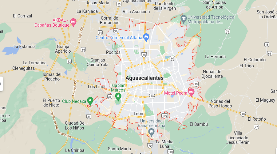
The economy of the state is diverse, with a focus on manufacturing and industry, as well as agriculture and tourism. The state is also home to several universities and research institutions.
The state is known for its hot springs, which gave the state its name, “Aguascalientes” which means “hot waters” in Spanish.
Aguascalientes Statistics
- Elevation – The highest point is Cerro de la Cruz de Piedra with an elevation of 2,300 ft (701 m), while the lowest point is the Laguna de San Francisco with an elevation of 1,890 ft (576 m).
- Area – 5,471 km²
- Population – 2,000,000
- Capital City – Ciudad de Aguascalientes
- International Airport(s) – Mr. Jesús Terán Peredo International Airport
- Official Website – https://www.aguascalientes.gob.mx/
Baja California
Baja California is a state located on the Baja California Peninsula in northwest Mexico. It is divided into two parts: Baja California Norte and Baja California Sur.
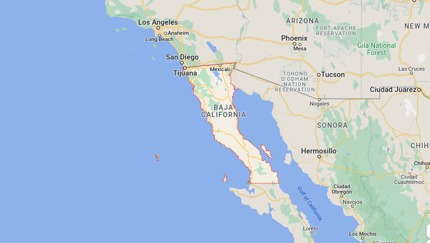
This is one of the states in Mexico that is known for its beautiful beaches, scenic desert landscapes, and rich marine life. The economy of the state is largely based on tourism and manufacturing, particularly in the automotive industry.
The state is also home to many agricultural operations, including vineyards and wineries. The state’s population is around 4 million people. Baja California is also known for its beautiful and diverse wildlife, this is a popular destination for ecotourism and outdoor activities such as hiking, surfing, and fishing.
Baja California Statistics
- Elevation – The highest point is Cerro de la Encantada with an elevation of 7,246 ft (2,211 m), while the lowest point is the Sea of Cortez with an elevation of sea level.
- Area – 73,948 km²
- Population – 4,000,000
- Capital City – Mexicali
- International Airport(s) – Tijuana International Airport, Ensenada International Airport, Loreto International Airport, San Felipe International Airport
- Official Website – https://www.baja-california.gob.mx/
Baja California Sur
Baja California Sur is located on the southern part of the Baja California Peninsula in northwest Mexico. Its capital and largest city is La Paz.
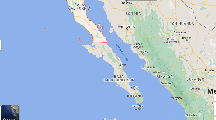
This is one of the many states in Mexico known for its beautiful beaches, clear turquoise waters, and rich marine life, making it a popular destination for tourists and water sports enthusiasts. The state’s economy is largely based on tourism, particularly in the areas of sport fishing, ecotourism, and luxury resort development.
Fishing and fish processing is also an important industry in Baja California Sur. Agriculture is also important, particularly in the cultivation of fruits and vegetables, as well as livestock. The state’s population is around 800,000 people.
Baja California Sur Statistics
- Elevation – The highest point is Cerro de la Calavera with an elevation of 8,015 ft (2,443 m), while the lowest point is the Sea of Cortez with an elevation of sea level.
- Area – 73,318 km²
- Population – 800,000
- Capital City – La Paz
- International Airport(s) – Los Cabos International Airport, La Paz International Airport
- Official Website – https://www.bcs.gob.mx/
Campeche
Campeche is a state in southern Mexico, located on the Gulf of Mexico. Its capital and largest city is also called Campeche. The state has a rich history, with many ancient Mayan sites, including the UNESCO World Heritage site of Calakmul.
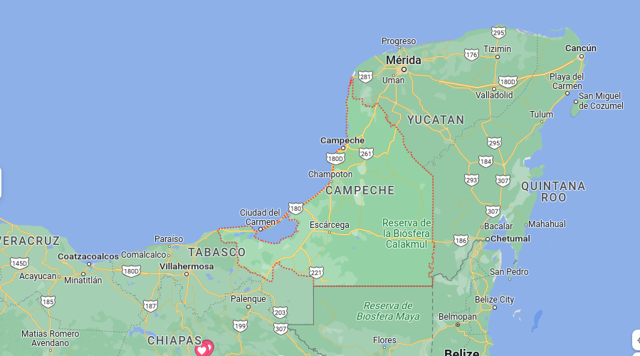
This state in Mexico is also known for its colonial architecture, particularly in the city of Campeche. The economy of the state is largely based on agriculture and fishing, as well as some light industry and tourism.
Campeche Statistics
- Elevation – The highest point is Cerro de Macuiltépetl with an elevation of 1,029 ft (313 m), while the lowest point is the Gulf of Mexico with an elevation of sea level.
- Area – 57,883 km²
- Population – 800,000
- Capital City – Campeche
- International Airport(s) – Campeche International Airport
- Official Website – https://www.campeche.gob.mx/
Coahuila
Coahuila is a state located in northeastern Mexico. Its capital and largest city is Saltillo. The state has a diverse geography, including deserts, mountains, and forests. Coahuila is one of the leading producers of iron and steel in Mexico.
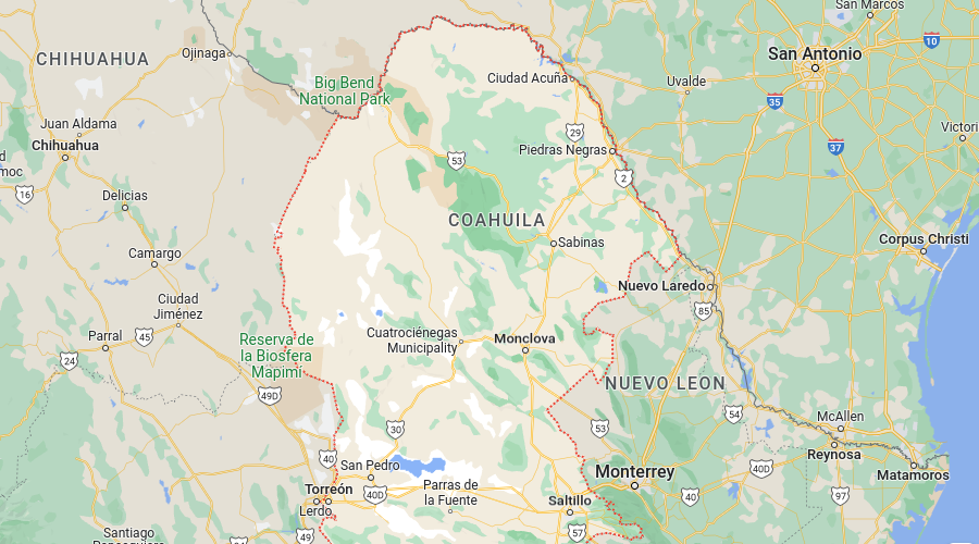
Its economy is also based on agriculture, mining, and manufacturing. This is one of the many states in Mexico that is home to universities and research institutions, and has a growing high-tech sector.
The state’s population is around 3 million people. Coahuila is also known for its rich history and culture, with many historical sites and museums, as well as traditional festivals and events. The state shares a border with Texas, United States.
Coahuila Statistics
- Elevation – The highest point is Cerro del Borrego with an elevation of 9,403 ft (2,865 m), while the lowest point is the Gulf of Mexico with an elevation of sea level.
- Area – 151,573 km²
- Population – 3,000,000
- Capital City – Saltillo
- International Airport(s) – Saltillo International Airport, Piedras Negras International Airport
- Official Website – https://www.coahuila.gob.mx/
Colima
Colima is a state located on the Pacific coast of Mexico, in the southwestern part of the country. Its capital and largest city is Colima. This is one of the states in Mexico that is known for its beautiful beaches, lush tropical forests, and active volcanoes.
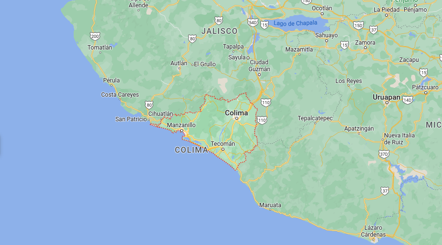
The economy of the state is based on agriculture, particularly in the cultivation of sugarcane, bananas, and other tropical fruits, as well as livestock. Fishing and tourism are also important industries in the state.
The state is also known for its rich history and culture, with many archaeological sites and museums. Colima is also known for its traditional crafts, such as pottery and textiles. This is one of the states in Mexico that is also known for its high seismic activity due to its location on the Pacific ring of fire.
Colima Statistics
- Elevation – The highest point is Volcán de Colima with an elevation of 12,631 ft (3,850 m), while the lowest point is the Pacific Ocean with an elevation of sea level.
- Area – 5,815 km²
- Population – 700,000
- Capital City – Colima
- International Airport(s) – Manzanillo International Airport
- Official Website – https://www.colima.gob.mx/
Chiapas (One of our Favorite States in Mexico)
Chiapas is a state located in southern Mexico, bordering Guatemala. Its capital and largest city is Tuxtla Gutierrez. The state is known for its diverse geography, including mountains, rainforests, and coastal plains.
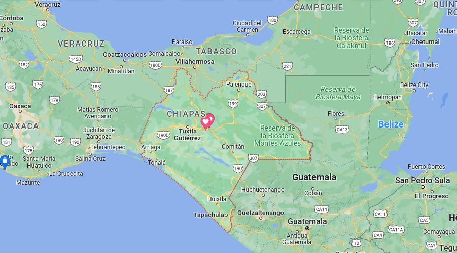
The economy of the state is based on agriculture, particularly in the cultivation of coffee, bananas, and other tropical fruits, as well as cattle raising. The state is also home to many indigenous communities that maintain traditional customs and practices.
Chiapas is also known for its rich history and culture, with many ancient Mayan ruins, colonial churches, and indigenous communities. The state is also known for its traditional crafts, such as textiles, pottery, and basketry.
This is another one of the states in Mexico that has a large population of indigenous people, and many of them still speak their traditional languages. The Zapatista movement, a group that advocates for indigenous rights and autonomy, is also active in the state
Chiapas Statistics
- Elevation – The highest point is Cerro El Cumbre with an elevation of 12,967 ft (3,950 m), while the lowest point is the Pacific Ocean with an elevation of sea level.
- Area – 73,947 km²
- Population – 5,000,000
- Capital City – Tuxtla Gutierrez
- International Airport(s) – Tuxtla Gutiérrez International Airport, Tapachula International Airport
- Official Website – https://www.chiapas.gob.mx/
Chihuahua
Chihuahua is a state located in northern Mexico, bordering the United States. Its capital and largest city is Chihuahua. The state is known for its diverse geography, including deserts, mountains, and forests.
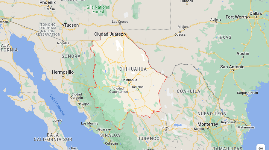
The economy of the state is based on mining, agriculture, and manufacturing. Chihuahua is one of the most important mining states in Mexico, particularly in the production of copper, gold, and silver. The state is also home to many large-scale cattle and sheep ranches.
This state in Mexico is also known for its rich history and culture, with many historical sites and museums, as well as traditional festivals and events. The state has a long border with the United States and has a significant number of people living in both countries, this makes it a significant trade and commerce hub.
It’s also famous for its natural beauty, such as the Copper Canyon, a series of deep canyons that are home to a diverse array of plants and animals.
Chihuahua Statistics
- Elevation – The highest point is Cerro de la Campana with an elevation of 9,710 ft (2,960 m), while the lowest point is the Rio Grande with an elevation of 1,800 ft (550 m).
- Area – 247,082 km²
- Population – 3,500,000
- Capital City – Chihuahua
- International Airport(s) – Chihuahua International Airport, Ciudad Juarez International Airport
- Official Website – https://www.chihuahua.gob.mx/
Durango
Durango is a state located in the northern part of Mexico, with its capital city being also Durango. It is known for its rugged and diverse terrain, including mountains, forests, and deserts.
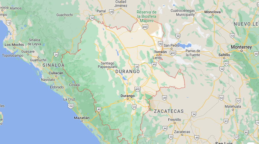
The economy of the state is based on mining, agriculture, and manufacturing. Durango is one of the most important mining states in Mexico, particularly in the production of silver, gold, and other minerals. The state is also home to large-scale cattle and sheep ranches.
Durango has a rich history and culture, with many historical sites and museums that reflect the state’s mining, agricultural and indigenous heritage. This state in Mexico is famous for its colonial-era towns such as Durango, Tepehuanes, and Mapimí, which have beautiful architecture and rich cultural traditions.
Durango is also known for its natural beauty, such as the Sierra Madre Occidental, which is home to a diverse array of plants and animals, and the Mezquital Valley, which is an important agricultural region.
The state also offers many outdoor activities like hiking, camping, and rock climbing, as well as adventure sports like paragliding, hot air ballooning, and skiing.
Durango Statistics
- Elevation – The highest point is Cerro de Mercado with an elevation of 11,894 ft (3,622 m), while the lowest point is the Laguna de Mayrán with an elevation of 4,921 ft (1,500 m).
- Area – 123,451 km²
- Population – 1,600,000
- Capital City – Durango
- International Airport(s) – Durango International Airport
- Official Website – https://www.durango.gob.mx/
Mexico City (Remember, CDMX is not one of the States in Mexico, but a Federal Entity)
Mexico City, also known as Ciudad de México or CDMX, is the capital and largest city of Mexico.
Mexico City has a rich history and culture and is home to many important historical and cultural sites. These include the ancient Aztec city of Tenochtitlan, the National Museum of Anthropology, and the Templo Mayor, as well as many colonial-era buildings such as the Metropolitan Cathedral and the National Palace.
The city is also known for its vibrant and diverse neighborhoods, such as the historic center of Mexico City, also known as Centro Histórico, which is home to many of the city’s most important landmarks and museums. Other notable neighborhoods include La Condesa, known for its lively nightlife and trendy restaurants, and San Angel, which is known for its charming cobblestone streets and colonial-era architecture.
Mexico City is also a major economic center in Mexico and Latin America, with a strong focus on finance, technology, and manufacturing. The city has a well-developed transportation infrastructure, including high-end hotels, a metro system, buses, and bike-sharing programs.
Mexico City Statistics
- Elevation – The highest point is Cerro de la Estrella with an elevation of 10,374 ft (3,163 m), while the lowest point is the Mexico City Valley with an elevation of 7,349 ft (2,240 m)
- Area – 1,485 km²
- Population – 21,000,000
- International Airport(s) – Benito Juarez International Airport, Mexico City International Airport
- Official Website – https://www.cdmx.gob.mx/
Guanajuato
Guanajuato is a state located in central Mexico, with its capital city being also Guanajuato. It is known for its rich history, culture, and colonial-era architecture. The state is also home to many important mining towns, such as San Miguel de Allende, which is a UNESCO World Heritage site and a popular tourist destination.
Guanajuato’s economy is based on agriculture, mining, and manufacturing. The state is one of the most important mining regions in Mexico, particularly in the production of silver, gold, and other minerals.
Agriculture is also an important industry in the state, with crops such as corn, beans, and wheat being grown in the region. Additionally, the state is home to many small- and medium-sized manufacturing companies, particularly in the automotive and aerospace industries.
Another one of the many states in Mexico that is known for its vibrant and diverse culture, which reflects its indigenous, colonial, and modern heritage. The state has many festivals, museums, and cultural centers that showcase its rich histories, such as the Alhondiga de Granaditas, the Museum of the Mummies, and the Diego Rivera Museum.
Guanajuato is also known for its natural beauty, such as the Bajio region, which is a large fertile plain, and the Sierra Gorda, which is a rugged mountain range. The state also offers many outdoor activities like hiking, camping, and rock climbing, as well as adventure sports like paragliding and hot-air ballooning.
Guanajuato Statistics
- Elevation – The highest point is Cerro de la Bufa with an elevation of 8,959 ft (2,728 m), while the lowest point is the Laguna de la Media Luna with an elevation of 5,905 ft (1,800 m).
- Area – 30,958 km²
- Population – 6,000,000
- Capital City – Guanajuato
- International Airport(s) – Del Bajío International Airport, León International Airport
- Official Website – https://www.guanajuato.gob.mx/
Guerrero
Guerrero is a state located in the southern part of Mexico, with its capital city being Chilpancingo. It is known for its diverse geography, including mountains, forests, and beaches.
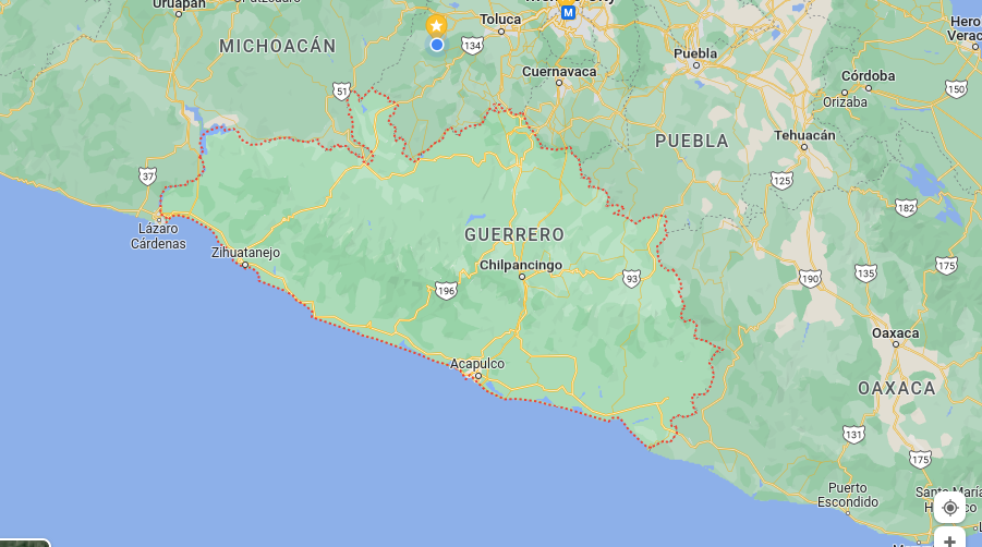
Guerrero is one of the poorest states in Mexico, with a high level of poverty and social inequality. Agriculture is an important industry in the state, with crops such as corn, beans, and coffee being grown in the region.
Fishing is also an important industry, particularly in the coastal areas of the state. Tourism has been a growing industry in Guerrero, particularly in the famous tourist destinations of Acapulco, Zihuatanejo, and Ixtapa.
Guerrero is another one of the states in Mexico that has a rich history and culture, with many important archaeological sites and museums that reflect the state’s indigenous heritage. The state is also home to many pre-Columbian ruins, such as the ruins of the ancient city of Taxco, the ruins of the ancient city of Tepoztlán, and the ruins of the ancient city of Cihuatán.
The state is also known for its natural beauty, such as the Sierra Madre del Sur, which is home to a diverse array of plants and animals, and the Pacific coast, which offers many beautiful beaches and scenic cliffs.
However, Guerrero has been facing a lot of security issues, with high rates of violence and crime, particularly in tourist areas, that have affected the tourism industry in the state.
Guerrero Statistics
- Elevation – The highest point is Cerro de la Barbilla with an elevation of 8,300 ft (2,530 m), while the lowest point is the Pacific Ocean with an elevation of sea level.
- Area – 63,619 km²
- Population – 3,500,000
- Capital City – Chilpancingo
- International Airport(s) – Acapulco International Airport
- Official Website – https://www.guerrero.gob.mx/
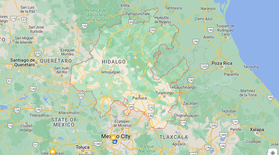
Hidalgo
Hidalgo is a state located in the central-eastern region of Mexico, with its capital city being Pachuca.
Agriculture is an important industry in the state, with crops such as corn, beans, and wheat being grown in the region. The state is also home to many small- and medium-sized manufacturing companies, particularly in the automotive and aerospace industries. Additionally, Hidalgo is an important mining region in Mexico, particularly in the production of silver and gold.
This is yet another one of the states in Mexico that has a rich history and culture, with many important historical sites and museums that reflect the state’s indigenous and colonial heritage. The state is home to many pre-Columbian ruins, such as the ruins of the ancient city of Tula, the ruins of the ancient city of Teotihuacan, and the ruins of the ancient city of Tepoztlán.
The state is also known for its natural beauty, such as the Huasteca region, which is known for its waterfalls, caves, and lush vegetation. The state also offers many outdoor activities like hiking, camping, and rock climbing, as well as adventure sports like paragliding and hot-air ballooning.
Hidalgo is also known for its vibrant and diverse culture, which reflects its indigenous, colonial, and modern heritage. The state has many festivals, museums, and cultural centers that showcase its rich history, such as the Museum of the Mummies of Tula, the Museum of Anthropology and History of Hidalgo, and the Museum of the Templo Mayor.
Hidalgo Statistics
- Elevation – The highest point is Cerro Tepozteco with an elevation of 11,959 ft (3,640 m), while the lowest point is the Mexico City Valley with an elevation of 7,349 ft (2,240 m).
- Area – 21,813 km²
- Population – 2,800,000
- Capital City – Pachuca
- International Airport(s) – Tizayuca Regional Airport
- Official Website – https://www.hidalgo.gob.mx/
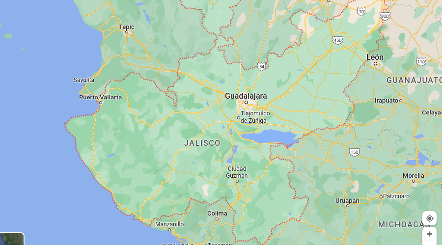
Jalisco
Jalisco is a state located in the western part of Mexico, with its capital city being Guadalajara. It has a population of around 8 million people.
Jalisco is one of the most economically important states in Mexico, with a diverse economy that includes agriculture, manufacturing, and services. The state is known for its rich agricultural tradition, particularly in the production of crops such as corn, beans, and avocados. Jalisco is also a major producer of tequila.
This state in Mexico has a rich history and culture, with many important historical sites and museums that reflect the state’s indigenous, colonial, and modern heritage. The state is home to many pre-Columbian ruins, such as the ruins of the ancient city of Tequila, the ruins of the ancient city of Tlajomulco, and the ruins of the ancient city of Tonalá.
The state is also known for its natural beauty, such as the Sierra Madre Occidental, which is known for its rugged terrain, and the Pacific coast, which offers many beautiful beaches and scenic cliffs.
Jalisco is also known for its vibrant and diverse culture, which reflects its indigenous, colonial, and modern heritage. The state has many festivals, museums, and cultural centers that showcase its rich histories, such as the Tequila Museum, the Museum of the City of Guadalajara, and the Degollado Theater. The state is also known for its traditional Mexican folklore, such as mariachi music and charrería (Mexican rodeo).
Jalisco Statistics
- Elevation – The highest point is Cerro El Ceboruco with an elevation of 8,631 ft (2,630 m), while the lowest point is the Pacific Ocean with an elevation of sea level.
- Area – 78,607 km²
- Population – 8,000,000
- Capital City – Guadalajara
- International Airport(s) – Guadalajara International Airport, Puerto Vallarta International Airport, Tepic International Airport
- Official Website – https://www.jalisco.gob.mx/
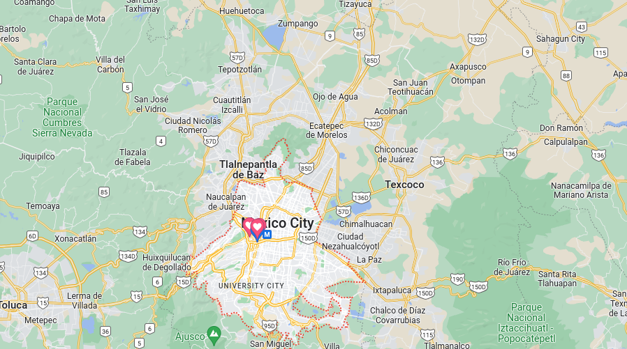
Mexico (Another one of the States in Mexico We’ve Lived In)
The State of Mexico (also known as “EdoMex” or “Edomex”) is a federal entity located in the central-western region of Mexico, with Toluca as its capital city. It has a population of around 16.3 million people and is one of the most populous states in Mexico.
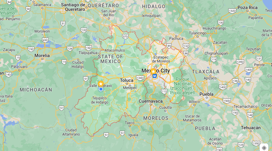
The State of Mexico is a major economic center in the country, with strong industrial and service sectors. It is home to major companies and industries such as automotive, aerospace, and consumer goods manufacturing. It also happens to be the state we’re living in right now. Specifically in Valle de Bravo, which we highly suggest checking out.
This is another one of the states in Mexico that is a major producer of agricultural products, including corn, beans, and fruits. The state is home to many important commercial and business centers, such as the Santa Fe business district in Mexico City, and it is also a major transportation hub with a network of highways and airports.
The State of Mexico has a rich history and culture, with many important historical sites and museums that reflect the state’s indigenous, colonial, and modern heritage. The state is home to many pre-Columbian ruins, such as the ruins of the ancient city of Teotihuacan, the ruins of the ancient city of Tula, and the ruins of the ancient city of Xochimilco.
The State of Mexico is also known for its vibrant and diverse culture, which reflects its indigenous, colonial, and modern heritage. The state has many festivals, museums, and cultural centers that showcase its rich histories, such as the Museum of Anthropology and History of Mexico, the Museum of the Templo Mayor, and the Museum of Modern Art.
Mexico Statistics
- Elevation – The highest point is Cerro de Tancítaro at 4,480 meters (14,700 feet) and the lowest point is Laguna de Terminos at sea level.
- Area – 30,221 km²
- Population – 16,000,000
- Capital City – Toluca
- International Airport(s) – Felipe Ángeles International Airport
- Official Website – https://www.mexico.gob.mx/
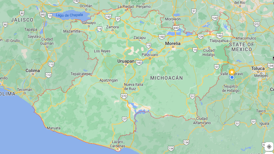
Michoacán
Michoacán is a state located in the western part of Mexico, with its capital city being Morelia. It has a population of around 4.5 million people.
This is another one of the states in Mexico that is known for its rich agricultural tradition, particularly in the production of crops such as avocados, limes, and tropical fruits. It is also a major producer of Mexican honey and hosts the largest beekeeping industry in Mexico.
Michoacán is also known for its rich history and culture, with many important historical sites and museums that reflect the state’s indigenous, colonial, and modern heritage. The state is home to many pre-Columbian ruins, such as the ruins of the ancient city of Tzintzuntzan, the ruins of the ancient city of Tzurumutaro, and the Purépecha archaeological site.
The state is also known for its natural beauty, such as the Sierra Madre del Sur, which is known for its rugged terrain and biodiversity. The state is also home to the Monarch Butterfly Biosphere Reserve, which is a UNESCO World Heritage site and one of the most important sites for Monarch butterfly conservation in the world.
Michoacán Statistics
- Elevation – The highest point is Nevado de Toluca at 4,680 meters (15,354 feet) and the lowest point is Laguna de Cuitzeo at 1,150 meters (3,772 feet).
- Area – 58,593 km²
- Population – 4,500,000
- Capital City – Morelia
- International Airport(s) – Morelia International Airport, Uruapan International Airport
- Official Website – https://www.michoacan.gob.mx/
Morelos
Morelos is a state located in the central region of Mexico, with its capital city being Cuernavaca. It has a population of around 2.3 million people.
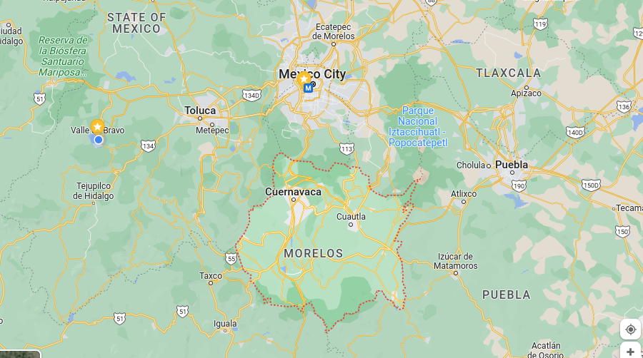
This state in Mexico is known for its rich history and culture, with many important historical sites and museums that reflect the state’s indigenous, colonial, and modern heritage. The state is home to many pre-Columbian ruins, such as the ruins of the ancient city of Xochicalco, the ruins of the ancient city of Tepoztlán, and the ruins of the ancient city of Tlayacapan.
The state has a diverse economy that includes agriculture, manufacturing, and services. It is a major producer of flowers, fruits, and vegetables. The state is also known for its production of tequila.
Morelos is also known for its vibrant and diverse culture, which reflects its indigenous, colonial, and modern heritage. The state has many festivals, museums, and cultural centers that showcase its rich histories, such as the Morelos Museum of Popular Art, the José Martí National Library, and the Cuernavaca Cathedral.
Cuernavaca, the capital city of Morelos, is known as the “City of Eternal Spring” due to its mild climate, beautiful gardens and the presence of many cultural and artistic events all year round.
Morelos Statistics
- Elevation – The highest point is Cerro de Tepozteco at 2,924 meters (9,594 feet) and the lowest point is the Tehuacán-Cuicatlán biosphere reserve at 1,200 meters (3,937 feet).
- Area – 4,938 km²
- Population – 2,300,000
- Capital City – Cuernavaca
- International Airport(s) – Cuernavaca International Airport
- Official Website – https://www.morelos.gob.mx/
Nayarit
Nayarit is a state located on the Pacific coast of Mexico, with its capital city being Tepic. It has a population of around 1.5 million people.
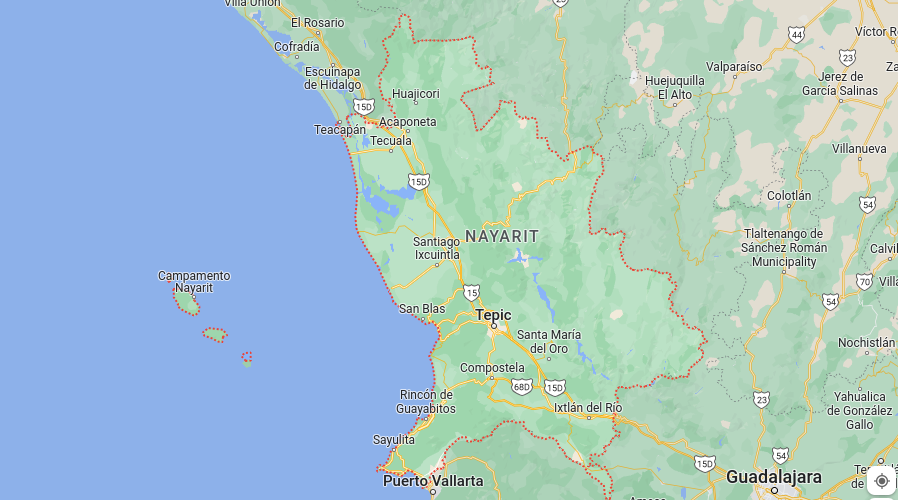
Nayarit is known for its natural beauty, with a long coastline on the Pacific Ocean and many beaches and bays. The state is also home to the Sierra de Nayarit, which is a mountain range that is known for its rugged terrain and biodiversity. The state is also home to the Nayarit Riviera, which is a popular tourist destination known for its beaches, resorts, and water sports.
This state in Mexico is also known for its rich history and culture, with many important historical sites and museums that reflect the state’s indigenous, colonial, and modern heritage. The state is home to many pre-Columbian ruins, such as the ruins of the ancient city of Ixtlán del Río, the ruins of the ancient city of San Francisco de Cuellar, and the Huichol Indian Museum.
Nayarit is also known for its vibrant and diverse culture, which reflects its indigenous, colonial, and modern heritage. The state has many festivals, museums, and cultural centers that showcase its rich history, such as the Tepic Museum of Popular Art, the Nayarit Museum of Popular Cultures, and the Tepic International Film Festival.
Nayarit Statistics
- Elevation – The highest point is Cerro del Nayar at 3,106 meters (10,197 feet) and the lowest point is the Pacific Ocean at sea level.
- Area – 27,828 km²
- Population – 1,500,000
- Capital City – Tepic
- International Airport(s) – Tepic International Airport, Bahia de Banderas International Airport
- Official Website – https://www.nayarit.gob.mx/
Nuevo León
Nuevo León is a state located in the northeastern region of Mexico, with its capital city being Monterrey. It has a population of around 5.1 million people.
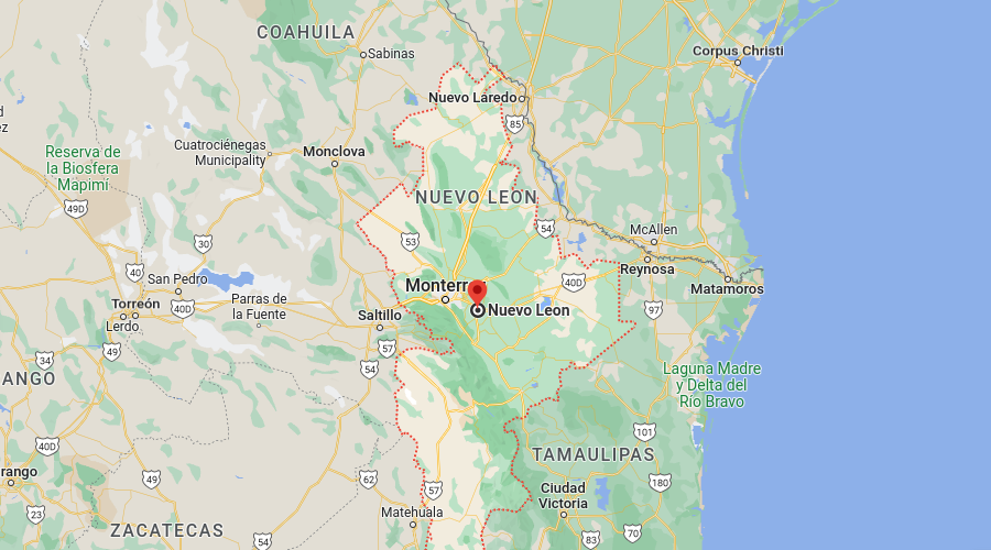
Nuevo León is known for its strong economy; it is one of the most industrialized states in Mexico, with a diversified economy that includes manufacturing, services, and agriculture. The state is home to many important industries, such as steel production, cement, chemicals, and textiles.
Nuevo León is also known for its vibrant culture, which reflects its indigenous, colonial, and modern heritage. The state has many festivals, museums, and cultural centers that showcase its rich history, such as the Museum of the Desert, The Museum of the Northeast, and the Museum of the Memory and Tolerance.
This is yet another one of the states in Mexico that is also home to many universities, including the Universidad Autónoma de Nuevo León and the Tecnológico de Monterrey, which are two of the most important universities in Mexico.
Nuevo León Statistics
- Elevation – The highest point is Cerro de la Silla at 2,014 meters (6,614 feet) and the lowest point is the Rio Grande at 85 meters (279 feet).
- Area – 64,937 km²
- Population – 5,100,000
- Capital City – Monterrey
- International Airport(s) – Monterrey International Airport
- Official Website – https://www.nl.gob.mx/
Oaxaca (The Best Food out of all of the States in Mexico)
Oaxaca is a state located in the southern region of Mexico, with its capital city being Oaxaca de Juarez. It has a population of around 4 million people.
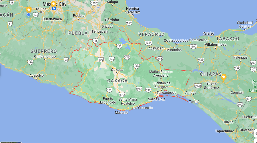
Oaxaca is known for its rich culture, which reflects its indigenous heritage. The state is home to many indigenous groups, including the Zapotec, Mixtec, and Mazatec, each with their own distinct languages and customs. The state is also known for its traditional crafts, including textiles, pottery, and basketry.
Like many states in Mexico, Oaxaca is also known for its historic and archaeological sites, such as the ancient city of Monte Alban, which was a major center of the Zapotec civilization. The state is also home to many colonial-era churches and buildings, such as the Temple of Santo Domingo de Guzman, which was built in the 16th century.
Oaxaca is also known for its gastronomy, which is considered one of the most diverse and delicious in Mexico; it’s famous for its traditional dishes such as mole, tlayudas, and chapulines.
Oaxaca Statistics
- Elevation – The highest point is Cerro San Felipe del Oro at 3,715 meters (12,182 feet) and the lowest point is the Pacific Ocean at sea level.
- Area – 93,765 km²
- Population – 4,000,000
- Capital City – Oaxaca de Juarez
- International Airport(s) – Xoxocotlán International Airport
- Official Website – https://www.oaxaca.gob.mx/
Puebla
Puebla is a state located in the central region of Mexico, with its capital city being Puebla de Zaragoza. It has a population of around 6 million people.
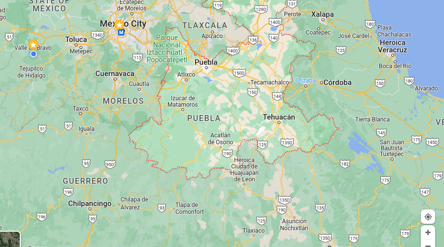
One of the many states in Mexico known for its rich history and cultural heritage. The state is home to many colonial-era buildings and historic sites, such as the Puebla Cathedral, which is considered one of the most important colonial-era buildings in Mexico.
The state is also home to many other historic sites, such as the Talavera pottery workshops, which are famous for their traditional pottery, and the Great Pyramid of Cholula, which is one of the largest ancient pyramids in the world.
Puebla is also known for its natural beauty, with many protected areas such as the Popocatepetl and Iztaccihuatl National Park, which is home to two of Mexico’s highest volcanoes, and the Los Tuxtlas Biosphere Reserve, which is home to many species of plants and animals.
Puebla Statistics
- Elevation – The highest point is Volcán Popocatépetl at 5,426 meters (17,802 feet) and the lowest point is the Atoyac River at 1,080 meters (3,543 feet).
- Area – 34,950 km²
- Population – 6,000,000
- Capital City – Puebla de Zaragoza
- International Airport(s) – Hermanos Serdán International Airport
- Official Website – https://www.puebla.gob.mx/
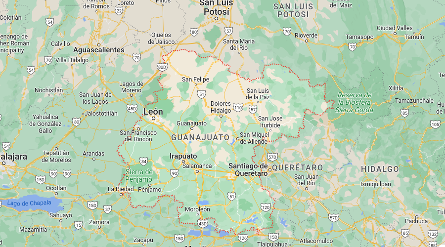
Queretaro
Querétaro is a state located in the central region of Mexico, with its capital city being Santiago de Querétaro. It has a population of around 2.7 million people.
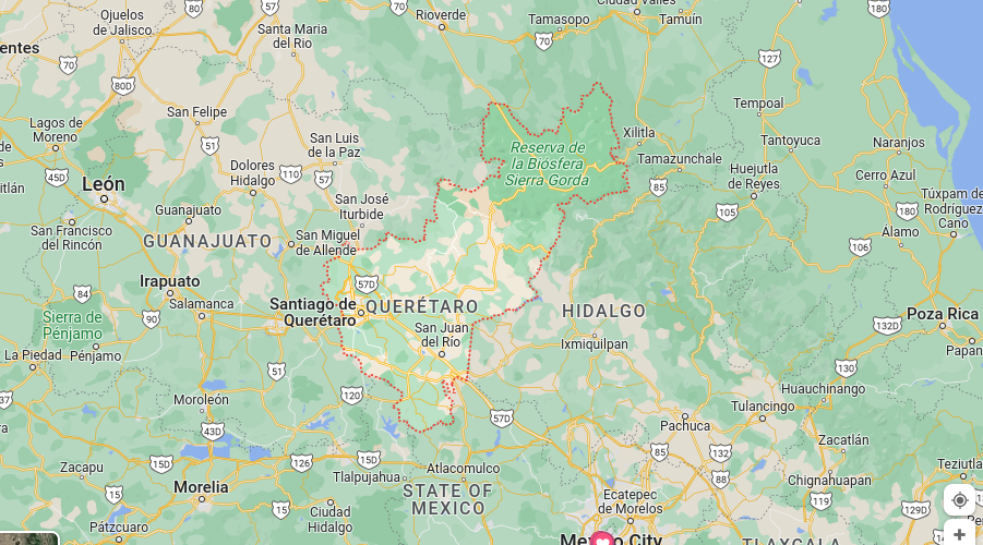
Querétaro is known for its rich history and cultural heritage, the state is home to many colonial-era buildings and historic sites, such as the Querétaro Cathedral, which is considered one of the most important colonial-era buildings in Mexico.
The state is also home to many other historic sites such as the Aqueduct of Santiago de Querétaro, which is an impressive architectural work and the Convent of Santa Rosa, which is a well-preserved colonial building.
Querétaro is also known for its traditional food. It is considered one of the most diverse and delicious in Mexico, and is famous for its “queso fresco” cheese, “cajeta” (a sweet made from caramelized goat’s milk), and “pozole” (a traditional Mexican stew).
Querétaro Statistics
- Elevation – The highest point is Cerro de las Campanas at 2,865 meters (9,396 feet) and the lowest point is the Rio Santa Maria at 1,020 meters (3,346 feet).
- Area – 22,903 km²
- Population – 2,700,000
- Capital City – Santiago de Querétaro
- International Airport(s) – Querétaro International Airport
- Official Website – https://www.queretaro.gob.mx/
Quintana Roo (One of the Most Visited States in Mexico)
Quintana Roo is a state located in the southeastern region of Mexico, with its capital city being Chetumal. It is known for its Caribbean coastline, which includes famous tourist destinations such as Cancun, Playa del Carmen, and the island of Cozumel. The state has a population of around 1.9 million people.
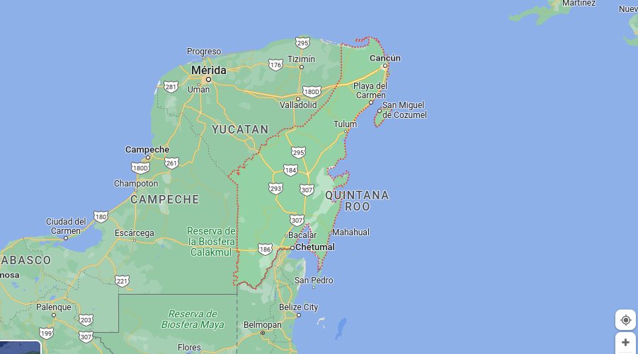
Quintana Roo is a popular tourist destination known for its beautiful beaches, crystal clear waters, and vibrant nightlife. The state’s economy is heavily dependent on tourism, and it is home to many resorts, hotels, and other tourism-related businesses. Cancun, in particular, is one of the most popular tourist destinations in Mexico, attracting millions of visitors each year.
The state is also home to many ancient Maya ruins, such as Tulum and Chichén Itzá, which are UNESCO World Heritage sites. These ruins are important examples of Maya architecture and are popular tourist attractions.
The state’s capital city Chetumal is the main port of entry to the state and the Yucatan Peninsula. It has a mix of modern and colonial architecture, and it is also home to several museums, such as the Oxtankah Archaeological Site and the Chetumal Regional Museum, which has exhibits on the history and culture of the state.
Quintana Roo Statistics
- Elevation – The highest point is Risco de Oro at 135 meters (443 feet) and the lowest point is the Caribbean Sea at sea level.
- Area – 50,212 km²
- Population – 1,900,000
- Capital City – Chetumal
- International Airport(s) – Cancun International Airport, Cozumel International Airport, Playa del Carmen International Airport
- Official Website – https://www.quintanaroo.gob.mx/
San Luis Potosi
San Luis Potosi is a state located in central Mexico. Its capital is the city of San Luis Potosi. The state has a population of around 2.8 million people.
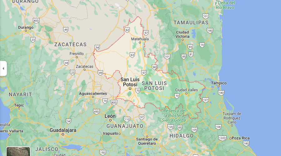
This state in Mexico is home to many colonial-era towns and cities, such as Real de Catorce, which was once a major silver-mining center, and the state capital, San Luis Potosi, which has a well-preserved historic center.
The state’s economy is diverse, with significant industries such as mining, manufacturing, and agriculture. San Luis Potosi is known for its production of silver, gold, zinc, and lead. It is also home to several industrial parks, which host companies from various sectors, including automotive, aerospace, and electronics.
San Luis Potosi is also known for its natural beauty, which includes hot springs, caves, and waterfalls. The Huasteca Potosina region is particularly known for its natural wonders, such as the Tamul Waterfall, which is one of the highest in Mexico, and the Micos Waterfall, which is surrounded by a natural swimming pool.
The state is also home to many cultural and historical events, such as the Festival of Baroque Music, which is held in San Luis Potosi annually and features performances of music from the Baroque period.
Another important event is the International Festival of Theater and Dance, which is held in the city of San Luis Potosi and features performances from national and international theater and dance companies.
In general, San Luis Potosi is a state with a rich cultural heritage, a diverse economy, and a wealth of natural beauty.
San Luis Potos Statistics
- Elevation – The highest point is Cerro del Potosí at 4,210 meters (13,810 feet) and the lowest point is the Tamasopo River at 460 meters (1,509 feet).
- Area – 63,183 km²
- Population – 2,800,000
- Capital City – San Luis Potosi
- International Airport(s) – Ponciano Arriaga International Airport
- Official Website – https://www.slp.gob.mx/
Tourism in San Luis Potos
100 words or so
Sinaloa
Sinaloa is a state located in northwestern Mexico, on the Gulf of California. Its capital is the city of Culiacán. The state has a population of around 2.8 million people.
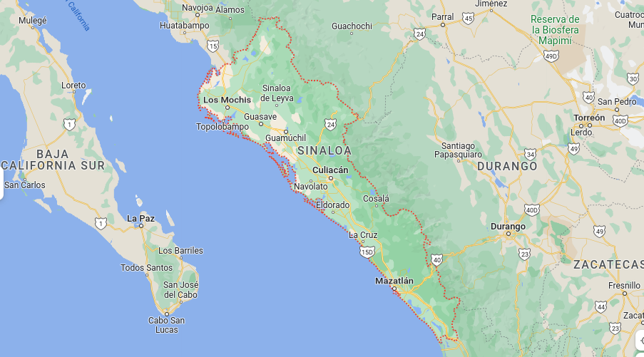
Sinaloa is another one of the states in Mexico that is known for its agriculture, particularly its production of crops such as corn, beans, and sorghum, as well as for its fertile land for the cultivation of tropical fruits and vegetables. Sinaloa is also known for its livestock production and fishing industry.
The state is also known for its rich cultural heritage, which is reflected in its traditional music, festivals, and art. Sinaloa is home to many traditional festivals, such as the Festival de la Candelaria, which is celebrated in the state capital, Culiacán, and features traditional music and dance performances.
Sinaloa is also known for its beaches, such as those located in the municipalities of Mazatlan and Los Mochis, which are popular tourist destinations. The state also has a number of ecotourism sites, such as the El Novillo Dam, which is home to a variety of bird species, and the El Cajón Dam, which is a popular spot for fishing and water sports.
Sinaloa Statistics
- Elevation – The highest point is Cerro El Cumbre at 2,924 meters (9,594 feet) and the lowest point is the Gulf of California at sea level.
- Area – 57,977 km²
- Population – 2,800,000
- Capital City – Culiacán
- International Airport(s) – Culiacán International Airport, Mazatlan International Airport
- Official Website – https://www.sinaloa.gob.mx/
Sonora
Sonora is a state located in northwestern Mexico, bordering the United States to the north. Its capital is the city of Hermosillo. The state has a population of around 2.8 million people.
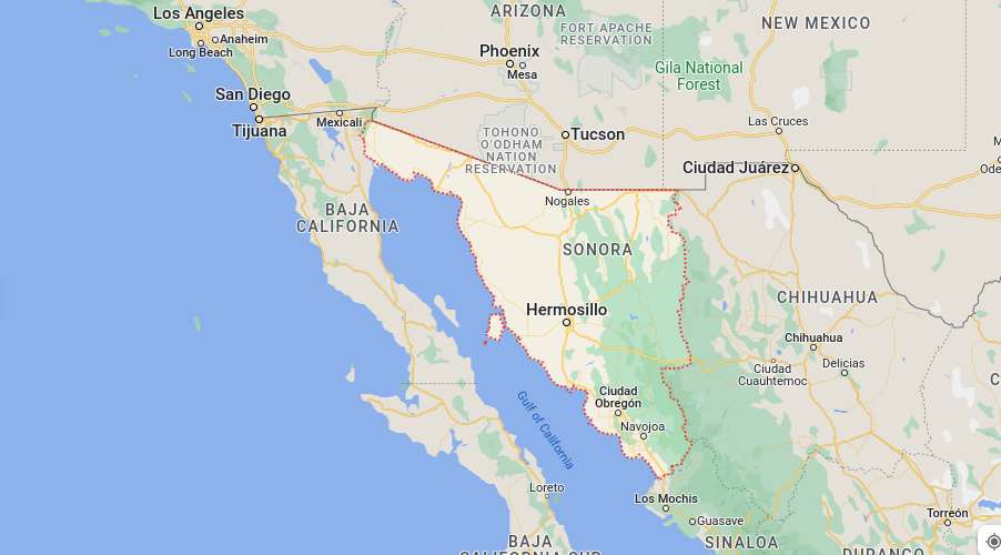
This state in Mexico is known for its natural beauty, including the Sonoran Desert, which covers a large portion of the state. The state is also home to a variety of plant and animal species, including the saguaro cactus and the Sonoran pronghorn.
Sonora is also known for its mining industry, which produces a variety of minerals, including copper, gold, and silver. The state is also home to a number of maquiladoras, which are foreign-owned factories that assemble products for export.
Sonora is also known for its beaches, such as those located in the municipalities of Guaymas and San Carlos, which are popular tourist destinations. The state also has a number of ecotourism sites, such as the El Pinacate y Gran Desierto de Altar Biosphere Reserve, which is home to a variety of plant and animal species.
Sonora Statistics
- Elevation – The highest point is Cerro Eligio at 3,093 meters (10,157 feet) and the lowest point is the Gulf of California at sea level.
- Area – 181,195 km²
- Population – 2,800,000
- Capital City – Hermosillo
- International Airport(s) – Hermosillo International Airport, Guaymas International Airport
- Official Website – https://www.sonora.gob.mx/
Tabasco
Tabasco is a state located in southeastern Mexico, bordering the Gulf of Mexico to the east. Its capital is the city of Villahermosa. The state has a population of around 2.5 million people.
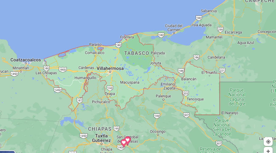
Tabasco is one of the states in Mexico that is known for its tropical climate, which allows for the cultivation of a variety of crops, including oil palm, sugarcane, and tropical fruits. Agriculture is a major industry in the state, with oil palm being the most important crop.
Tabasco is also known for its natural beauty, including the Tabasco River, which runs through the state, and the Los Pantanos de Centla Biosphere Reserve, which is home to a variety of plant and animal species.
Tabasco Statistics
- Elevation – The highest point is Cerro El Vigía at 350 meters (1,148 feet) and the lowest point is the Gulf of Mexico at sea level.
- Area – 24,788 km²
- Population – 2,500,000
- Capital City – Villahermosa
- International Airport(s) – Villahermosa International Airport
- Official Website – https://www.tabasco.gob.mx/
Tamaulipas
Tamaulipas is a state located in northeastern Mexico, bordering the United States to the north. Its capital is the city of Ciudad Victoria. The state has a population of around 3.2 million people.
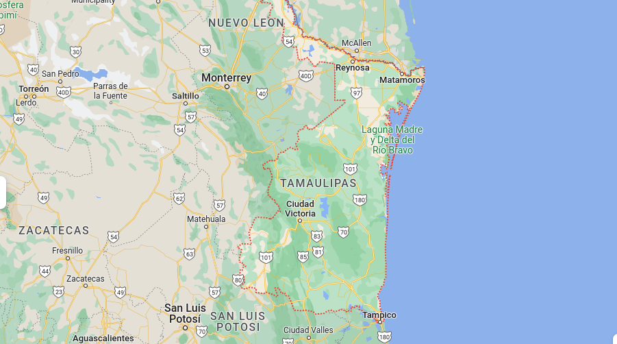
Tamaulipas is known for its strong economy, which is based on agriculture, manufacturing, and oil production. Agriculture is a major industry in the state, with crops such as cotton, sorghum, and corn being grown. The state is also home to several manufacturing industries, particularly in the automotive and construction sectors. Additionally, Tamaulipas is an important producer of oil in Mexico, with several major oil fields located in the state.
This state in Mexico is also known for its natural beauty, including the Laguna Madre, a large bay that is home to a variety of plant and animal species. The state is also home to the El Cielo Biosphere Reserve, which is known for its diverse ecosystems and rare species of animals and plants.
Tamaulipas Statistics
- Elevation – The highest point is Cerro El Potosí at 2,865 meters (9,396 feet) and the lowest point is the Gulf of Mexico at sea level.
- Area – 80,113 km²
- Population – 3,200,000
- Capital City – Ciudad Victoria
- International Airport(s) – Tampico International Airport, Ciudad Victoria International Airport, Reynosa International Airport
- Official Website – https://www.tamaulipas.gob.mx/
Tlaxcala
Tlaxcala is a small state located in central Mexico, with a population of around 2 million people. Its capital is the city of Tlaxcala.
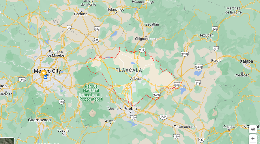
Tlaxcala is known for its rich cultural heritage and historical significance. The state was an important center of pre-Columbian civilization, and it has many ancient ruins and archaeological sites that are open to visitors. The state also has many traditional festivals and celebrations that reflect its indigenous heritage, such as the Guelaguetza Festival in Tepoztlan and the Tlaxcala Day.
The economy of Tlaxcala is primarily based on agriculture, with crops such as corn, beans, and wheat being grown. The state is also home to a number of manufacturing industries, including textiles, footwear, and furniture.
In general, Tlaxcala is a small state with a rich cultural heritage and historical significance. Its economy is based on agriculture and manufacturing, and its natural beauty is a major tourist attraction. It’s considered a relatively safe place to live and visit.
Tlaxcala Statistics
- Elevation – The highest point is Cerro El Gogorron at 4,220 meters (13,845 feet) and the lowest point is the Atoyac River at 1,080 meters (3,543 feet).
- Area – 4,238 km²
- Population – 2,000,000
- Capital City – Tlaxcala
- International Airport(s) – Tlaxcala International Airport
- Official Website – https://www.tlaxcala.gob.mx/
Veracruz
Veracruz is a state located on the Gulf of Mexico in eastern Mexico. It has a population of around 8 million people and its capital is Xalapa.
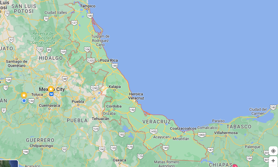
Veracruz is another one of the states in Mexico that is known for its diverse culture and history. The state was an important center of trade and commerce during the colonial period, and it has many historical sites and landmarks that reflect this legacy, such as the San Juan de Ulúa fortress and the Quiahuiztlán archaeological site.
Veracruz has a diverse economy with important agricultural, industrial, and service sectors. Agriculture is one of the main industries, with crops such as sugarcane, coffee, and oranges being grown. Oil and natural gas are also important for the state’s economy. The Port of Veracruz is a major trade hub for the country, and the state’s tourism industry is also a significant source of revenue.
Veracruz Statistics
- Elevation – The highest point is Cerro de Cofre de Perote at 4,220 meters (13,845 feet) and the lowest point is the Gulf of Mexico at sea level.
- Area – 71,815 km²
- Population – 8,000,000
- Capital City – Xalapa
- International Airport(s) – Veracruz International Airport, Xalapa-Enríquez International Airport
- Official Website – https://www.veracruz.gob.mx/
Yucatán
Yucatán is a state located in the southeast of Mexico, on the Yucatán Peninsula. Its capital is Mérida. The state has a population of around 2 million people.
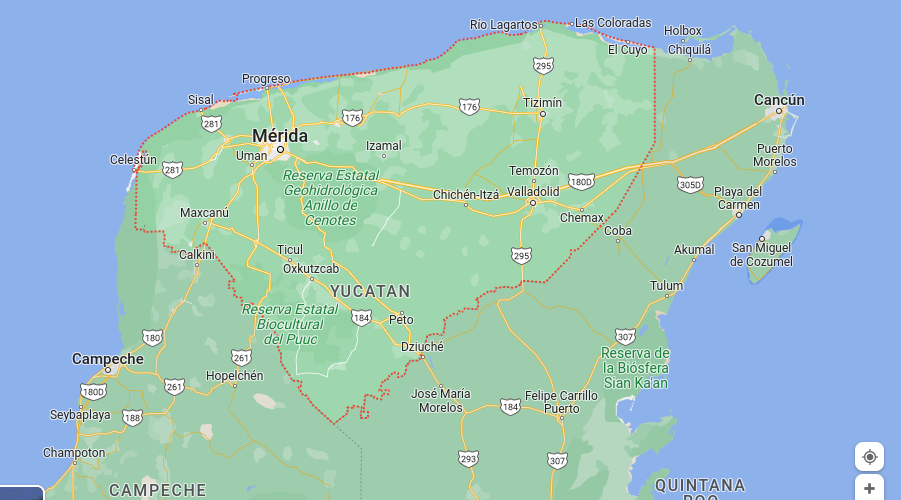
Yucatán is known for its rich cultural heritage and history, particularly the Mayan civilization, which had a significant presence in the region. There are many ancient Mayan ruins and archaeological sites in the state, such as Chichén Itzá, Uxmal, and Tulum, which are popular tourist attractions.
Yucatecan cuisine is also famous for its delicious and unique food, particularly the traditional dish of cochinita pibil.
In general, Yucatán is a state with a rich cultural heritage and history, known for its ancient Mayan ruins, traditional music and dance, and delicious cuisine. It’s also famous for its tropical climate and beautiful beaches. The state has a diversified economy with agriculture, and tourism being the most important sectors.
Yucatán Statistics
- Elevation – The highest elevation is Cerro Mulato at approximately 305 m (1,001 ft) and the lowest elevation is sea level.
- Area – 39,211 km²
- Population – 2,000,000
- Capital City – Mérida
- International Airport(s) – Mérida International Airport, Cancun International Airport
- Official Website – https://www.yucatan.gob.mx/
Zacatecas
Zacatecas is a state located in the central region of Mexico. It is known for its rich history, particularly in relation to the colonial era and the Mexican War of Independence. The state’s capital is Zacatecas City, which is a UNESCO World Heritage Site due to its well-preserved colonial architecture.
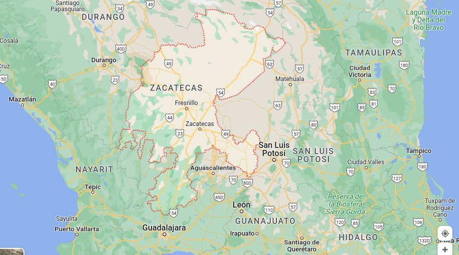
The economy of Zacatecas is primarily based on mining, with zinc, silver, and gold being the main minerals extracted. Agriculture and livestock farming are also important economic activities in the state.
In terms of tourism, this state in Mexico is known for its colonial-era architecture, including the Zacatecas Cathedral and the Templo de la Tercera Orden. The state is also home to several important museums, including the Zacatecas Museum and the Rafael Coronel Museum.
Zacatecas Statistics
- Elevation – The highest elevation is Cerro de la Campana at approximately 3,907 m (12,824 ft) and the lowest elevation is the Río Aguanaval at approximately 1,086 m (3,560 ft).
- Area – 75,284 km²
- Population – 1,600,000
- Capital City – Zacatecas City
- International Airport(s) – Zacatecas International Airport
- Official Website – https://www.zacatecas.gob.mx/
We Hope you Found our ‘States in Mexico’ Guide Helpful
We’ve been living here in Mexico for quite a while, and we’ve loved nearly everywhere we’ve lived. Out of all of the states in Mexico, though, we still haven’t found our favorite yet. For now, we’ll just bounce around from beach town to mountain town to lake town, hoping to find our forever home.

Paul is a full-time SEO content writer and owner of Word Brokers, LLC. He is also a full-time digital nomad who can be found writing content with his toes in the sand on a beach in Mexico, sipping an espresso in a cafe in Colombia, or chilling by the lake in Guatemala.
Related posts:
 Best Neighborhoods in Mexico City For Digital Nomads & Expats
 Zona Rosa, Mexico City: Is It Worth Moving To?
 Roma Norte, Mexico City: The Heart Of Mexican Cuisine And Art
 Top 10 5 Star Hotels In Mexico City – Luxury at its Finest
 Mexico Travel Tips: Travel Cheap on Flights, Buses & Colectivos
 Get 180 Days on Your Mexican Tourist Visa (FMM) – Our 10 Tips
2 Replies to “An Ultimate ‘States in Mexico’ Guide – Stats, Maps, & Info”